


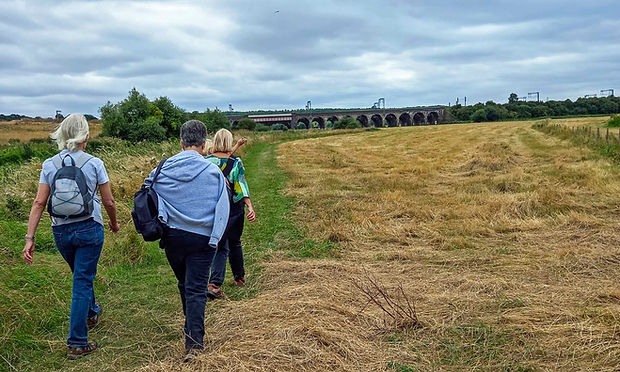
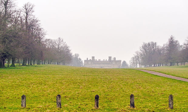
Pitsworth Reservoir - Post Christmas Walk – 29th December 2024

Pitsford Causeway - Brixworth Country Park - 7 Miles - 337ft Ascent
Twelve of us which was a combination of Rushden Ramblers and Grendon Walking Group met at the Pitsford Reservoir Car Park for our now annual post Christmas walk around the reservoir. With a watery sun just poking through the clouds we set off across the causeway to the path that goes around the reservoir. Being the 1st Sunday after Christmas the path was very busy with cyclists and runners. We soon reached the planned coffee stop after 2 miles and took a welcome break. After our coffee we continued on the path which winds its way in and out of the inlets for the streams that feed the reservoir. After 3½ Miles made our way over the dam passing the sailing club and then up hill to the Brixworth Country Park with its café and picnic area. Here after 4¼ miles we stopped for a longer break and some lunch. From here we took the shore path for 2¾ miles back to the causeway car park to complete a dry and satisfying walk that shed some of the Christmas excess.
Lowick – Drayton Park - Slipton - 2nd December 2024

Lowick – Drayton Park – Slipton - 4½ miles – 321ft Ascent
On a cold December day ten of us started from Drayton Road in Lowick and walked on the park road past the impressive Drayton House. Continuing on we passed the stable block and then walked through the parkland to Drayton Home Farm. We continued on to Slipton Church where we stopped for a coffee some of us sitting on the seat that famously collapsed with our members sitting on it in 2016. From the churchyard we continued on the footpath into Slipton. Turning right we walked through the village soon taking a road on the right that lead us back to the church where we re-traced our steps back to Lowick.
Earls Barton – Whiston Lock - 12th November 2024

Earls Barton - White Mills – Whiston Lock – 3¾ Miles 129ft Ascent
Ten of us started from Earls Barton Church on a dry bright day. On a great day for walking we set off downhill along Station Road. Soon we were out of the village and passing under the A45 road. Turning left back onto Station Road we made our way past White Mills Marina. Just before the bridge over the Rive Nene we turned right on to a footpath by the river. With the river on the left and the marina on the right we walked to a very old bridge over the river. Crossing over we then continued by the river on the right to Whiston Lock. Here we crossed over the river again and followed the path around a back water to a path which led us through the gravel workings to a track which we followed to a bridge over the A45. Soon we passed Whites Nursey on the left then climbed the hill back towards Earls Barton turning into the quaint Sunnyside and then on past the Tennis Club back to Station Road where we turned left back to the church.
Harrington - Arthingworth – 28th October 2024

Harrington – Newbottle Bridge – Arthingworth – 4¾ Miles – 398ft Ascent – Grade 1A - Shorter
After meeting at Duck Street eight of us met at the High Street in Harrington. The weather was grey and overcast as we set off past the Tollemache Arms (recently voted the best pub in Northamptonshire) heading off down the road to Harrington church here we visited the churchyard and admired the Cyclamen growing in masses around the trees. We all agreed to divert away from the planned route here as the path to Thorpe Underwood was extremely slippery and difficult to walk. So we continued on the road downhill to the Newbottle Bridge over the infant River Ise. Having crossed over the river we took a path across a muddy field to a track. We took the track which undulated along the Ise Valley ridge giving us expansive views despite the drizzle that had set in. On reaching a road we turned left and walked into Arthingworth to the church where we stopped for a break. After a welcome coffee we retraced our steps back along the road where we took a footpath which re-crossed the river over a pack horse bridge. From here we made our way through the fields heading for the area called The Falls however we had to divert again finding it impossible to walk across a newly ploughed field. Taking a detour via an adjacent bridleway we gained a different aspect of the fish ponds and the site of the Manor House. Although we walked in some rain at the finish we all agreed that it had been a lovely walk with some of us visiting the Tollemache Arms for lunch. A fitting end to a great walk.
Sharnbrook - Harrold Country Park – 27th October 2024
.jpg)
Sharnbrook – Harrold Country Park – Odell – 6¼ Miles – 295ft Ascent – Grade 2A - Longer
Eight of us travelled to the Yelnow Lane in Sharnbrook on a cloudy but dry day. Starting near the golf course we followed the badly rutted Yelnow Lane byway towards Santa Pod. After approximately 1 mile we turn off the track and followed a footpath at first through Yelnow Farm and then into Odell Woods. The walk through the woods was magical with the autumn colours and the rustle of fallen leaves. After a mile we emerged from the woods into beautiful autumn sunshine and lovely expansive views over the Ouse valley. The path now dropped gently downhill into Harrold Country Park. On reaching the path around the lake we walked to the Visitor Centre and Café where we stopped for lunch. After lunch we continued on around the lake to walk into Odell. Passing The Bell pub we diverted to the mill and the bridge over the river. Retracing our steps we walked to Odell church and then up Church Lane to a footpath on the right. Taking the path led us through a series of paddocks with a variety of stock grazing in the fields. Continuing on we crossed over several arable fields to join a bridleway. Following the bridleway around the fields then through Woodend Plantation to the Yelnow Road where we made are way back to the start. Perfect weather for a lovely autumn walk.
Twywell Hills & Dales – Twywell – 12th October 2024

Twywell Hills & Dales – Twywell – 3 Miles – 134ft Ascent – Grade 1A - Shorter
Seven of us met in the car park at Twywell Hills & Dales in the rain. We all decided to complete the walk and we set off in our waterproofs on and our umbrellas up. Leaving from the picnic area we headed north to the track of the disused railway and followed the track through the Hills & Dales Country Park. We emerged into a field from which we followed the clear path into Twywell. Turning right we walked down hill on the High Street to the far end of the village. On nearly reaching The Old Friar pub we turned right at a footpath sign for the Hills & Dales and followed the lane past some allotments into a field. Heading across the field we made our way back into the country park and walked through the woods back to the old quarry. Here the path went up and down through the quarry eventually arriving back at the car park.
Wymington – Irchester -Tuesday 10th September 2024
_JPG.jpg)
Wymington – Irchester Circular – Irchester Grange - 5 Miles – 350ft Ascent – Grade 1A - Shorter
Eight of us joined the walk on a dry though a bit dull and cloudy day. It was a pleasant walk from Wymington church walking to Green Lane then on to along some bridleways (some official some not) to the railway. We then walked alongside the railway to the bridge under it then made our way into Irchester. On reaching the playing field we walked along Arkwright Road then through a jitty to London End and then on the Farndish Road. Here we turned left and walked on the road out of Irchester. Passing Irchester Grange on the left we soon turned left at a byway which dropped downhill to a brook which we crossed and continued on back towards Wymington. After approximately 1 mile we turned left on to a footpath which led us through a pheasant rearing wood and then on back to Wymington over two railway bridges to return to Wymington church. We all agreed it was a lovely walk with interesting views a variety of things to see along the way.
Little Harrowden – Hardwick – Tuesday 27th August 2024
.jpg)
Little Harrowden – Hardwick – 4½ or 5 Miles – 220ft Ascent – Grade 1A - Shorter
Nine of us set off from Little Harrowden on a dry day with a breeze just prefect for walking. Following the Hardwick Road we turned off at a new development and walked into a large field – Walking around the edge we dropped downhill to a stream which we followed to a bridge – Crossing over we turned left on to a track still following the stream which was now on our left. We then crossed back over on a small bridge and climbed up a steep bank into a field. Heading across the field we headed for the hamlet of Hardwick. After crossing two fields we reached a road.( Here there is a choice to visit Hardwick). Turning left onto the road we walked to a crossroads. Crossing over we walked to a bridleway on the left which we followed for 1½ miles along the ridge until it joined the Great Harrowden road. Crossing over we dropped down to a plank bridge then up the other side back into Little Harrowden. On reaching Main Street we made our way back to the start.
Old Warden – Circular – Sunday 25th August 2024

Old Warden (Church) – Northill – Ickwell Green – Shuttleworth – 8 Miles – 300ft Ascent - Longer Walk – Grade 3A
On a lovely Bank Holiday Sunday, 5 members joined the Old Warden Circular Walk. Starting at Church End (donation charge, welcome), we headed from the top end of the Church car park following the footpath through Palmers Wood, where we came across a muntjac deer, basking in the morning sunshine. Out of the wood there were views across the valley seeing Haynes in the distance and a little way on standing on the ridge, gave us a vista across to Cardington Hangers and Bedford. Our path led us down an old green lane lined with extremely old Yew Trees, which is a part of the Greensand Ridge Walk footpath where we took our coffee break just before the path turned right. Here the location again, gave us superb views to the north and the Sandy Heath Transmitter. After being refreshed, we continued on passing Highland Farm and on into Home Wood where we came across a Deer Family, but they were rather wooden and a bit stiff. Within the wood we passed some Medieval Fish Ponds, but they are so overgrown that they are very hard to see. From here we headed up the hill, stopping to collect some apples from a generous home owner and then making our way into the village of Northill. Although the village pub The Crown would not allow us to eat our sandwiches on their premises, we enjoyed a welcome pint and comfort break there, before moving 250 yds across the car park, to sit by the duck pond, to eat our pack-ups. After being suitably refreshed, the next section was road walking of about a mile, which passed quickly, when admiring the wonderful houses that lined the route. Before long we were in the village of Ickwell Green, were on the large Green, a cricket match was in full swing, the Green being surrounded by very English Houses, was a typically English scene. Coming out of the village in a tunnel of hawthorn footpath and the sounds of the Merlin Engines flying overhead, it was very easy to think you were back in the 1940's when the Shuttleworth (Old Warden) Aerodrome was operational. We skirted old aerodrome field and continued on to our drinks stop in Lowsiebush Covert which gave us a welcome seat in the shade. At the end of the track, we turned right onto another road section that brought us to the Warden Warren Woods. Here we took a small detour and visited the Queen Charlotte's House which can be rented out. Returning to the woodland path we turned right down the hill, coming out at the entrance of the Shuttleworth Agricultural College. From here we walked the short distance back to the Church to complete our day out. Before leaving for home we all went into the Church and was wowed by the carpentry inside, the cravings and mezzanine floor is a must to see on this trip.
Weston Underwood – Ravenstone - 15th August 2024

Weston Underwood – 3¾ Miles – 265ft Ascent – Evening Walk - Grade 1A
Following a lovely sunny day 10 of us met in Weston Underwood in heavy rain. Waiting for the rain to ease, we all agreed to continue with the walk instead of going directly to the pub. Having set off up Wood Lane in a steady drizzle we were soon walking in the gloom with the drizzle being horizontal in the breeze. Passing ‘The Alcove’ which had people sheltering from the weather we continued on the road until it changed into a track. Walking through the undergrowth was very wet underfoot and those who had chosen to walk in walking shoes soon had very wet feet. After 1¼ miles we turned off the track to walk through a field which on a normal day would have had expansive views but today was just wet. The path led us through a tunnel of trees and bushes giving us a welcome relief from the rain. On reaching a road we turned left and walked into Ravenstone where we sheltered for a break on the small village green. After our break we walked through the village to a footpath on the left. Following the path uphill to an unusual stile mounted on a gate. Looking back we could see the most amazing sunset which because of the low cloud looked as through the landscape was on fire. Having crossed the stile, which was very high and very slippery we continued across the fields some of which were cloggy in the rain. We soon dropped down through several horse fields back into Weston Underwood and ended the walk in the dark. Those who had bought wet weather gear were wet but dry inside but those of us who had dressed for a summer walk were soaked through. We all decided that going to the pub was not practical and all agreed although it had been very wet we would not have seen the amazing sunset had we not walked.
Higham Ferrers (Wharf Road) – Chester House - 10th August 2024
Higham Ferrers (Wharf Road) – Chester House – 6½ Miles – 155ft Ascent – Medium - Grade 2A
On a dull but perfect day for walking at this time of the year 11 of us started from the bottom end of Wharf Road in Higham. Crossing over the A45 road and the River Nene we headed upstream along the Nene Way. Following the river on our left we soon passed Rushden Lakes and the shopping centre on the other side of the river and the delights of the sewage works on our side. On passing the works the path drifted away from the river and followed the works access road to Ditchford Lane. Here we carefully crossed over to pass the Chettles factory on the left. We soon returned to the river and walked to the railway viaduct. Passing under the railway we then had a short walk to the new bridge over the river into Chester House. Making our way to the very pleasant café where we had a welcome break and recharged our batteries. After our break we retraced our steps and returned to Higham on the same route which gave us a completely different aspect and views to the walk out.
Gayton – Rothersthorpe – Milton Malsor – A walk of Canals & Views - 28th July 2024
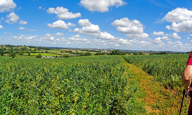
Gayton Junction – Gayton - Rothersthorpe – Milton Malsor – 8 or 5 Miles - 596ft or 200ft Ascent
On this walk we split the walk into longer and shorter options of 8 or 5 miles with the start of the longer walk being an hour before the shorter walk. Both walks started from the Gayton Junction Car Park near Gayton. On a very warm, sunny day 6 of us started from the car park on the longer walk. We were soon walking along the Grand Union Canal which had very welcome shade for 1½ miles. We then climbed away from the canal steeply uphill towards Gayton on reaching the top we stopped and admired the view over Northampton in a very welcome breeze. Walking on we passed through the village to the Gayton Spinney where we stopped for a break. After our break we walked past the church and took a path downhill back to the canal. In the meantime 3 of us had started the shorter walk from the car park and walked ½ mile to a bridge over the canal where we found a welcome bench, here we waited for the group doing the longer walk. We soon met up and made our way together on the footpath to Rothersthorpe passing the church to the Memorial Garden in the village. This part of the walk was in the sun so we took a welcome break before taking a footpath out of the village. We soon came to a road which we walked on carefully for ½ mile to the Northampton Arm Canal – Walking past the start of 17 locks which drop downhill into Northampton. Walking to a bridge we left the canal and climbed to a road. Bearing left and then right over the A43 we took a concrete access road to a footpath on the right. From here we crossed a series of grass fields to a road then into the village of Milton Malsor and the Greyhound pub where we had a very welcome drink in the garden. After our drink we made our way to a tree with a circular seat where we stopped for our lunch in the shade. After lunch we walked through the village took a footpath from the Gayton Road which took us back to the canal at Blisworth Junction. Now back in the welcome shade by the canal we walked back to the car park and the end of the walk. A lovely walk despite the heat and highly recommended.
Twywell to Twywell Hills and Dales – Thursday 25th July 2024

Twywell – Twywell Hills & Dales Country Park – 3 Miles – 104ft Ascent
On a dry but dull day 13 of met in the village of Twywell to walk on a revised route to Twywell Hills & Dales Country Park after the original route to Drayton Park was blocked by electric fences. Walk from the telephone box we walked up the gentle hill through the village to a footpath on the left. Taking the footpath which led us out of the village we walked the undulating path into the Twywell Hills & Dales Country Park. Soon we reached the picnic area with seats and a van selling all sorts of treats. After taking a break we looped around back on to the footpath and retraced our steps back to Twywell. On reaching the road we turned left and walked out of the village to a footpath on the right. After going over a rickety stile we walked across a ridge & furrow field back into the village and the telephone box. A lovely walk in a lovely part of Northamptonshire.
Thrapston - Tichmarsh Nature Reserve – Evening Walk – Fish & Chips Supper - Thursday - 11th July 2024

Thrapston (Meadow Lane) – Tichmarsh Nature Reserve – 3½ Miles – 61ft Ascent
Twelve of us started from the Meadow Lane Car Park in Thrapston on a damp chilly evening. Starting on a path at the back of the car park we immediately climbed a set of steps to take the path by the sailing lake. Following the winding path through the woods we soon joined the disused railway track which is part of the nature reserve. Soon branching off to the left we followed the path between the sailing lake and a smaller lake – On reaching the River Nene we turned left and walked on a path alongside the river. Walking upstream we listened to the bird song and admired the wild flowers both which flowered naturally and a patch where the Environmental Agency had created a wild flower sanctuary alongside the river. We continued on passing the Sailing Club on the left and Islip Mill on the right. Here we took a path off Meadow Lane and walked by the river to the Nine Arches Bridge over the river. On reaching the main road we turned left to make our way back into Thrapston. On reaching the Pisces Fish and Chip shop the walkers who were not having supper continued on the walk back to Meadow Lane. Eight of us who opted for the supper stopped for a very welcome meal in the fish & chip shop. After the supper we all made our way back to the car park and the start of the walk. Despite it being damp and overcast evening we all agreed it had been a perfect evening.
Swineshead – Kimbolton – 30th June 2024

Swineshead – Pertenhall – Kimbolton – 7¾ Miles – 408ft Ascent – Grade 2B
On a grey overcast morning 10 of us set off from the High Street in Swineshead (previously known as Suineshefet (1086) then Swynesheved (13th century) and then Swineshead in the 16th century. Once part of Huntingdonshire but surrounded by Bedfordshire, now firmly in North Bedfordshire). Leaving the village on the Swineshead Road we soon took a footpath with the characteristic wide open sky’s of this part of Bedfordshire. The footpath led us to the village Pertenhall and its lovely Norman church where we stopped after 2¼ Miles for a welcome coffee break in the sun. On leaving Pertenhall we made our way through open countryside across fields and on wide clear tracks to Kimbolton Cricket Club on the outskirts of Kimbolton. Here we stopped for lunch and many of us sampled the hospitality of the club bar which was opening just as we arrived. After lunch we took a footpath which led through Honeyhill Woods which had a wide selection of wild flowers and butterflies. Soon we reached an old drove road called Sandy Lane which we followed its weaving route back to Swineshead and the end of a lovely walk on what turned into a great day for walking.
Onley – Clifton Reynes – 18th June 2024

Olney – Olney Water Meadows – Clifton Reynes – 4¼ Miles – 131ft
Eight of us met in the Olney Rugby Club on a beautiful evening to walk from Olney to Clifton Reynes. Leaving from the Car Park at the recreation ground in East Street we walked by the children’s playground across the recreation ground to the River Ouse – We then walked on a path beside the river to a bridge. Walking over the bridge we turn right and climbed a short but steep hill and then walked across the fields to the road into Clifton Reynes. Turn right then left we walked past some allotments and on to a village road. Here we turned left and walked to a T junction by the Robin Hood Pub which is community owned. Unfortunately the pub was closed so we turned right and walked to Clifton Reynes Church for a short break. The church was unlocked and we had a look round before continuing on the walk. Leaving the church we turn right on to a track where we took a path right across a pasture field to a track. Turning right and then dropping down the hill back to the bridge over the river. Having crossed the river we walked straight on towards Olney Mill and the Church. Soon we passed the Mill on our left and walked on to Church Street. Just before the High Street we took a path to the right and walked through the public gardens to the High Street. Crossing over we made our way to The Bull Hotel where we stopped for a welcome drink. After our drink we then walked north on the High Street to the Cowper Memorial Church where we took a path through an arch which took us back to East Street and the cars. An absolutely lovely evening walk.
Melchbourne – Upper Dean – 8th June 2024

Melchbourne – Upper Dean – 4¾ Miles – 265ft Ascent
On a bright sunny day eleven of us led by Paul made our way from Melchbourne Village Hall passing St Johns Arms pub on the left and continuing on through Grange Farm and Dean Lodge. At the road we turned left and walked past The Compasses pub on the left before making our way to the church where we stopped for a welcome coffee break. From the church we made our way to the High Street where we turned right and walked to a bridleway. Walking past Lodge farm we soon turned right and followed the path around Hay Wood before passing Eastfields Farm. Walking on to a crossroads we crossed over and walked on the road to a metal kissgate on the right. This led us across a field to to some rough ground which we followed a meandering path through back to the village hall.
Oxford Colleges Walk – Awayday – Sunday 26th May 2024

Shorter Walk – Oxford City Centre – River Cherwell – River Thames – 3¼ Miles – 64ft Ascent
Longer Walk - Oxford City Centre – River Cherwell – River Thames – University Parks – River Cherwell – 6 Miles – 113ft Ascent
On a wet, dull morning eighteen of us travelled from Northamptonshire to the Pear Tree Park & Ride on the outskirts of Oxford to catch the bus into city centre. The sun greeted us on arrival as we made our way to the start of the walk. We first visited the Martyrs Cross to hear the gory details of Anglian priests being burnt at the stake. We then carried on to the interesting Covered Market and all its differing stalls and produce. Continuing on to Blackwell’s Book Shop, with the largest book room in the world, we then made our way past the the Sheldonian Theatre, which was designed by Christopher Wren. From here we moved on to the Bridge of Sighs which joins Hertford College together. We then entered a narrow alley which led to the 17th century Turf Inn, which was unfortunately closed (too early!!) and admired the list of celebrities who have drunk at the pub. From here we retraced our steps and made our way to the Bodleian Library and its spectacular architecture which dates back to the 14th Century. We then made the short walk to the Radcliffe Camera, this circular library is probably considered by most locals and visitors as “the very centre of Oxford”, it was built in 1749 by James Gibbes and has an Edwardian Palladian style and has over 600,000 books stored there. We then made our way to St Marys Passage where we came across a doorway which it is said to have inspired C. S. Lewis’ Chronicles of Narnia. Turning left we walked past St Marys church which is thought to be the oldest church in Oxford and if you climb the tower gives spectacular views if the city. Carrying on we walked to Magdalen College. The college took over the site of St John the Baptism Hospital, alongside the River Cherwell. It first used the hospital’s buildings and completed a new construction between 1470 and 1480. On leaving the Magdalen we made our way to the bank of the River Cherwell and walked alongside the river with its punts, to the River Thames. Here we turned right and walked along the Thames to a path which led us to Christ Church College. Built by Henry VIII, Christ Church is renowned for its stunning architecture, rich history, and academic excellence. The Great Quadrangle, also known as Tom Quad, is the largest quadrangle in Oxford. From here we made our way to the Tom Tower, designed by Sir Christopher Wren, stands at the entrance to the quad and houses the Great Tom bell, which rings 101 times each night. Moving on we passed the ornate Post Office to the Carfax Tower is all that remains of the 12th century St Martin's Church, the official city church of Oxford from 1122. In 1896, the main part of the church was demolished to make more room for traffic in the area. We now walked through the main shopping area to Bulwalks Lane a footpath which led us to the gothic fire station and corn exchange was built in George Street by Thomas Axtell in 1894–6. From here we walked to the Ashmolean Museum. The Ashmolean came into existence in 1682, when the wealthy antiquary Elias Ashmole gifted his collection to the University. It opened as Britain’s first public museum, and the world’s first university museum, in 1683. From the museum we made our way to the Martyrs Memorial where the short walk finished. Here we split into two groups with the people undertaking the short walk making the short walk back into the city centre for lunch. This left nine of us to continue on the longer walk. We stopped and had lunch on the steps of the memorial in the sun. After lunch we made our way past Balloil, St Johns and Keble Colleges to enter into the University Parks. Walking through past the university cricket pitches to the River Cherwell. Here we turned right and walked by the river through the park. On reaching a T junction we went left over back waters of the river until we met the main river again where we turned again to walk alongside the river on a clear mown path. However after a mile the path petered out and we had to retrace our steps and walk though St Catherines College to walk back into Oxford. We all decided that a cup of tea or coffee would be very welcome so we walked back to the Covered Market and had a welcome drink before making our way back to the car park. While we were in the market the weather changed and the forecast heavy rain arrived. We all agreed we had timed it just right on what had been a great day.
Harrold – Poddington Airfield – Tortoise Walk - Thursday 9th May 2024

Harrold (White Lane) – Podington Airfield – Park Wood – 4¼ Miles – 224ft Ascent
Eight of us met at the White Lane on the outskirts of Harrold on a bright sunny day. Following the White Lane for 1 mile we emerged from Odell Great Wood into the edge of Podington Airfield. Coming to the perimeter road we turned left and walked around the edge of the airfield with its enormous wind turbines. Soon we reached a wide path on the left and followed it past some buildings and then on to Grange Farm which looked like a graveyard for old trucks. Passing through the farm we soon reached the Podington /Harrold road. After turning left for a few meters we took a footpath on the right to climb up to Park Wood and its bluebells. On reaching a junction of paths we turned left on to what started as a path but soon turned into a wide track which led us downhill into Harrold. After passing a few houses we turned off the road to the left. Passing over a brook we then turned left again across some paddocks to a lake with a waterfall. Bearing left again we walked on a path to a stile on the right. Crossing over another paddock back to the Poddington/Harrold road again, turning left on to road we walked back to the start. Lovely walk on a lovely day
Mantles Heath Bluebell Walk – Ramble – 28th April 2024

Mantles Heath – Litchborough – Farthingstone – 7 Miles - 356ft Ascent
Following an early morning deluge 10 of us met at a layby near Mantles Heath Wood. Setting off in what was compared to the earlier rain a gentle drizzle we walked on the Knightley Way with the Mantles Heath Woods on our left. We soon experienced waterlogged conditions underfoot with kiss gates being under water. However the drizzle stopped and we made our way past Knightley Woods. Walking on a combination of bridleways and footpaths after 1¾ miles we stopped for a coffee break in a small copse which had a very unusual fungus on the trees. After coffee we continued on for another ½ miles to the Litchborough – Maidford road. Here we turned left and walked to the outskirts of Litchborough. Taking a footpath on the left we walked through some small holdings and then some parkland to Litchborough church. Turning left we walked through the village to re-join the Knightley Way on the right. Up to now the walk had been, for this part of Northamptonshire, unusually level however it now turned into the up and down terrain we had all expected as we followed the path from Litchborough to Farthingstone on reaching the road we turned left through the village to the Joy Mead Gardens where we had lunch. The Joy Mead Gardens are a delightful place with hidden gardens with stone cloisters and a small temple with a large lawn area. The gardens were created by the Agnew family in 1922 to commemorate their two children who had died through illness and injuries from the Great War. After lunch we walked past the Crockery Cottage which instead of having flint built into the walls this was faced by plates, cups and saucers etc. Still following the Knightley Way we made our way over the access road to Farthingstone Golf Course and on to an enclosure with deer inside. Although the walk had been very muddy underfoot here it became a game of skipping from one piece of harder ground to another. After ½ mile of difficult walking we reached Mantles Heath Wood which was carpeted with the most magnificent show of Bluebells. We climbed steadily through the woods on a much drier path back to the start and the end of a very wet/muddy but highly recommended walk.
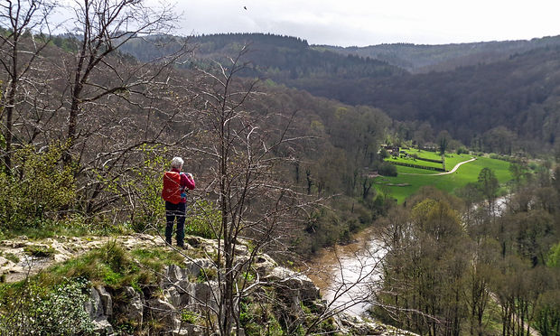
Spring Weekend Away – Symonds Yat – 5th to 7th April 2024 - Sunday Walk

Broom Hill – Yat Rock – 5 Miles – 500ft Ascent (Easier) or 5¼ Miles – 650ft Ascent
All eleven walkers met at the Broom Hill Car Park near Christchurch to set off together on a forest walk to Yat Rock. We made our way to the forest tack which weaved its way through the beautiful Forest of Dean. After 1¼ miles of fairly flat but muddy walking we passed Mailscot Lodge and then dropped steeply downhill. Some of us commented on the seat at the top of the slope which we all agreed was there to rest when walking the other way. Also there was a warning sign advising mobility scooters not to travel down the hill! Continuing on the path we made our way over the access road into the car park and continued on to Yat Rock. Here it started to rain as we admired the views over the Wye Valley from the rock. We then crossed over the road by the pedestrian bridge and made our way to another view point over looking Symonds Yat. Here we had a coffee break at some picnic tables near the café and then made our way to the car park and the toilets. Here six of us decided to walk back on a more strenuous route. So we split up with the group on the easier route who made their way back by walking up the car park access road to the path we walked in on. From here we made our way back to the Broom Hill Car Park by retracing our steps our walk which included taking an obligatory rest at the seat top of the steep hill. The more strenuous route left the car park by the exit road to join the main path. Soon we branched off to the right and walked through the heart of the forest crossing over several streams and walking through some very muddy areas. The final sting in the tail was a very steep hill back up to the Broom Hill Car Park. At the top and with impeccable timing we met the remainder of the group who had walked back the less strenuous way. So we re-joined together to walk the few metres back to the car park. A memorable walk and a fitting end to our weekend away.
Spring Weekend Away – Symonds Yat – 5th to 7th April 2024 - Saturday Walk - Easier

Symonds Yat (West) – Biblins – 6 Miles – 700ft Ascent
On a dull but unseasonal warm day with temperatures close to 18 degrees six of us set off from the Old Court Hotel. We walked through Sterrets Caravan Park to the River Wye. Here we took the riverside path towards the Olde Ferrie Inn. The path resembled a bog with the river having recently flooded. However we took our time to plot the best way through and eventually made it to the Inn. Climbing the steep slope up the Inns access road we turned left to walk on Ferrie Lane through the village. On reaching the pedestrian ferry access we checked that the ferry was not running. We found the jetty flooded confirming that there would be no ferry ride. We continued on, soon leaving the village behind and passing the site of an old Iron Works – Continuing beside the river we walked through woods with Wild Garlic and Blue Bells flowering. The walk continued by the river until we reached the Biblins Adventure Centre and the rope (wire) bridge over the river. Here we stopped for lunch sheltering from a brief rain shower under a handy shelter. With the ferry not operating we returned the way we had come but as is usual with linear walks the walk back gave us a completely different aspect to the walk seeing things we had not seen on the way. On reaching the Olde Ferrie Inn on the way back we decided to walk back via Ashes Lane which rose above the village and gave us some lovely views. The final sting in the tail was the steep slope downhill back to the hotel. We all agreed it had been a lovely walk.
Spring Weekend Away – Symonds Yat – 5th to 7th April 2024 - Saturday Walk - Strenuous
Symonds Yat (West) – King Arthurs Cave – Doward Hill Fort – Seven Sisters Rocks – Biblins – 7¼ Miles – 1625ft Ascent
Five of us set of from The Old Court Hotel to almost immediately climb up a very steep hill on our way to Kings Arthurs Cave. Being a very warm day, by the time we had climbed 100 metres we were stripping off having got overheated. Soon the gradient eased and although we were still climbing we became less heated as we walked on numerous muddy footpaths and tracks. After about a mile the route levelled off and we walked along pleasant country lanes with numerous wild flowers in the verges. Now we started to loose height and we entered into White Rocks Nature Reserve passing the campsite shop on the way offering ice creams for sale. Surprisingly no one was tempted. We then dropped down to King Arthurs Cave where we took a short break. The cave is known for its history much of which is myth with King Arthur being almost everywhere. After our short break we began climbing again following the path up to the Doward Hill Fort. The walk took us through woods carpeted with Wood Anemones and Blue Bells. On entering the fort we walked around the clear earthworks to a trig point and a perfect view point. From here we could see the whole of the centre of the fort which was covered with yellow Primroses. We then walked around the edge of the fort to a rocky ledge which formed part of the defences. Here we stopped at some convenient rocks for a coffee stop which was cut short because it was a very windy spot and being caught in a sharp rain shower. The path left the fort and we retraced our steps downhill back to the cave. Bearing right we took a path which followed the edge of the Wye Valley giving us glimpses of the river many feet below us. The path traversed up some scrambles and through some very muddy areas until we walked out onto the top of the Seven Sisters Rocks with amazing views of the Wye Valley. Returning to the main path we continued on until we joined a major forest track which led us downhill to the Biblins Adventure Centre. We then made our way past the Biblins Rope (wire) Bridge and on to some picnic tables where we stopped for our lunch. After lunch we returned to the bridge which we had planned to cross and walk to the pedestrian ferry in Symonds Yat (East). However the ferry was not operating because the river was very high and running too quickly. So we took a few photos and took the path back to Symonds Yat on the west side of the river. After a very pleasant stroll we arrived at the pedestrian ferry jetty which was under at least 3ft of water. We then resumed our walk which took us through the village on Ferrie Lane to the Olde Ferrie Inn. Dropping down into the Inn we took advantage of the hospitality and had a very pleasant drink beside the river. After our break we then took the riverside path from the Inn. This turned out to be the wettest section of the walk with the river having recently flooded the path. After a difficult ½ mile we arrived at Sterrets Caravan Park where we washed our boots of in a convenient puddle and walked on the footpath through the site back to the hotel and the end if the walk. We all agreed that we had a fantastic varied day.
Brampton Woods – Ramble – 31st March 2024
Brampton Woods – Grafham Water – Grafham – 6 or 9 Miles
On a typical British Easter Day, which started off bright, became increasingly blowy and grey skies above, 8 members gathered at Brampton Woods Nature Reserve Car Park on the outskirts of Graftham to start our walk. Brampton Woods is the second largest woodland area in Cambridgeshire, spanning 132 acres and is at least 900 years old. Due to the recent heavy rains, we kept to the main rides, as a lot of the permissive footpaths were closed. Due to this we were unable to view the bluebells at the east end of the reserve, however a few bluebells were spotted in the West Wood that we passed by later in the walk, these were just beginning to show their vivid blue . Coming out of the woods on the North side, we turned left onto the bridleway, noticing, wild primroses, stitchwort, a wild pear tree and a Witches Elm tree. Crossing Graftham Road we joined the Three Shires Way, passing Old Manor Caravan Park on our left. This section was again very muddy, lots of standing water, we had to splash across. Turning off the Three Shires Way, we stopped for a quick coffee and Easter Chocolate Cake break (thanks to one of our members) on the beach of the Fisherman's Car Park area on Graftham Water, where we were luckily enough to see, one of the anglers pull a decent size Trout out of the water. Here we stayed on the orbital trail around the Reservoir, as the water's edge footpath was under water. We headed into Graftham, for our lunch stop at the Trout Inn and Village Shop. Both facilities were very welcoming to walkers with good seating area outside. Just as we were packing our things together, we did experience slight mizzle, but within moments the blistery wind blow it over. We continued down, Brampton Road, which is a single carriageway with passing places, stopping off the read about the Moated Compound on our right as we passed. Dotted along the road were pockets of wild primroses, showing that spring is here and hopefully better weather to come. This route was 6 miles which can be lengthen if required to 9 miles, if ground is firm and the woods are dry.
Aldwincle – Wadenhoe Saturday 23rd March 2024 –Tortoise Walk

Aldwincle - Wadenhoe - Achurch - Thorpe Waterville - 4.5 Miles - 194ft Ascent
Ten of us started from near St Peters Church in Aldwincle on a bright Saturday morning. Taking Nene Way we followed the waymarked path initially through fields which gave us lovely views of the River Nene. Soon we crossed a planked bridge and then we walked uphill through a wooded area. On emerging from the woods we walked into Wadenhoe passing the village church St Michael and All Angels perched on a hill to the left. Just before we reached Wadenhoe the path was very slippery but the walkers took their time and no one fell into the mud. We walked on uphill through the village passing the The George pub on the right. At the T junction we turned right into Mill Lane and passed Wadenhoe House. We dropped down to the river and the weir. We then crossed the white bridge by Mill House and followed the path across a meadow to a high bridge over the navigable part of the river. By now dark clouds had appeared. But the rain held off as we walked uphill to emerge near a farmyard and onto the Achurch church. We continued on following the footpath to the Thorpe Waterville road. Here we turned right and walked through the hamlet of Achurch and on to Thorpe Waterville – Here we turned right again and walked back to Aldwincle. Fortunately it didn’t rain and we were able to finish the walk without getting wet. A lovely walk and highly recommended.
Castle Ashby – Tortoise – 11th March 2024
Castle Ashby – Chadstone – Denton – 4½ Miles – 195ft Ascent
On a gloomy but dry day eleven of us set off from the village of Castle Ashby expecting a very wet and soggy walk following the amount of rainfall over the previous 2 or 3 days. We set off across the pasture field near the Castle Ashby house to where the road crosses the drive to the house. Here we admired the drive and the house. We then made our way on the road to the small hamlet of Chadstone. From here we dropped down to a brook taking in the misty but lovely views over the countryside. Crossing over a brook we then had a steady climb up to the village of Denton and the lovely village green. From here, after stopping for a break, we made our way past Manor Farm which had lambing in full swing. We soon left the village and made our way to another brook which we walked along to the Paradise Ponds at Chadstone. These used to be fish ponds managed by what was a monastery back in the medieval period. Walking past the ponds we made our way uphill back through Chadstone to the Castle Ashby road. Turning left we walked back into Castle Ashby. We all agreed that it had been a remarkably mud free walk and that it was well worth doing.
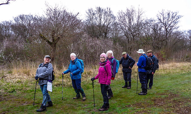
Byfield – Woodford Halse – Ramble – 25th February 2024

Byfield – West Farndon – Woodford Halse Nature Reserve – Woodford Halse - 7½ Miles – 615ft Ascent
On a cold frosty morning 10 of us made our way to the village of Byfield which is situated in the folds of the northern edge of the Cotswolds, in the south-western corner of Northamptonshire, some four miles east of the intersection with the boundaries of Oxfordshire and Warwickshire. On the journey we drove through some low mist and fog but on arrival the mist cleared, the sun came out and melted the frost away. Parking near the Village Hall and the Playing Field we made our way out of the village passing over 3 very high stiles which had us thinking this was going to be an interesting challenge if they were all this high. We were soon distracted by passing through a farm which was a graveyard for old cars, tractors and other vehicles. Passing through the farm we made our way to a road called The Twistle which means a boundary stream. Turning left we passed over the stream and then climbed up hill to the A361 road. Crossing over we then continued the climb on a farm access road to the the top of Farndon Hill a height of nearly 600ft. This gave us magnificent views over the countryside and set the standard for the views on the walk. Soon the farm access road turned into a bridleway which was remarkably free of mud when taking into account the deluge of rain we had experienced in the week before the walk. The bridleway now dropped downhill to the hamlet of West Farndon which we passed through crossing over the infant River Cherwell and then by the Mill House. Climbing again we made our way across several pasture fields to the Woodford Halse Nature Reserve where we stopped for coffee. The nature reserve is part of the old Great Central Railway line which has been designated as the nature reserve. Rather than take the risk of walking through the old railway cutting and getting bogged down we took the easier route on the reserve access road. However the relief from the mud was short lived as we had to take a bridleway that was churned up by horses. This led to ¾ mile of mud hopping until we got some relief when we met a minor road. However this was relief was only temporary as on turning left we then climbed Woodford Hill to Cherry Tree Farm which is again over 600ft. From the farm we walked along a ridge with more magnificent views. However after ½ mile we had to drop down then up again before finally dropping down into Woodford Halse. We then made our way to the Fleur de Leys pub where we stopped for lunch and drink. After lunch we walked through the village which is in the parish of Woodford cum Membris. It includes the village of Hinton and the hamlet of West Farndon. Hinton and Woodford Halse are separated by the River Cherwell and the former course of the Great Central Main Line railway. The village was formerly served by the Great Central Railway, which provided significant local employment and included Woodford Halse railway station which opened in 1899 and closed in 1966. We continued on into Hinton and walked past the striking Woodford Halse Social Club which was the old Railway Hotel. We then walked on out of Hinton and crossed a ridge and furrow pattern of old common fields. From here we made our way back to Byfield aiming for the prominent spire of Byfield village church. There was one more sting in the tail with the highest stile of day just before the last field. However having negotiated the stile we made our way back to the cars. We all agreed that although it had been a testing day particularly in the muddy conditions the views and walk easily outweighed the inconveniences and we all had a great day.
Priory Country Park to Bedford Town Centre– Tortoise – 3rd February 2024

Priory Country Park – River Ouse Embankment – Bedford Town Centre - 3¾ Miles – 26ft Ascent
Twelve of us travelled to the Priory Country Park in Bedford for a relatively dry underfoot walk alongside the River Ouse and Bedford Town Centre. The weather was good for this time of the year and it kept dry with blue sky for the walk. At first we followed the Bedford to Sandy Country Way passing the Marina on the left heading towards Bedford. We kept on the path until we came to a signpost pointing the way to Bedford Town. On the left we passed the unusual Pyramid Oasis Swimming Pool. Here we turned right and passed over the river to the Embankment. From here we turned left and walked with the river on our left to the Castle Mound on the right. On crossing the road we walked down Newnham Road passing the Castle Mound. We passed the Higgins Bedford Gallery and Museum on the left and the Panacea Museum on the right then turned left into Castle Road through an alleyway to the High Street. Turning left we walked to St Pauls Square and on turning right we passed through the market and the Corn Exchange into the Harpur Centre where we stopped for a break as there are seats here. After admiring the The Meeting Place sculpture we made our way back to St Pauls Square and crossed over into Merchant Place and the new bridge over the river that leads to the college. After crossing we then walked by the river following the footpath all the way along the river on the left. This took us back to the Sandy Country Way and the Priory Country Park.
28th January 2024 – Bedford Figure of Eight – Ramble

Priory Country Park – River Great Ouse – Bedford Embankment – 6½ Miles – 25ft Ascent
Nine of us set off from a very busy (packed with runners undertaking a 10 mile run) Priory Country Park in Bedford and walked on the disused railway track towards Bedford town centre. Just before a bridge across the river we branched left to walk alongside the river Great Ouse for a mile passing the Kingfisher Hotel on the way. On reaching Cardington Lock we followed a path back into the country park and the sailing lake with lots of dinghy’s on the choppy water. Here we turned away from the lake and the Ouse Valley Way with a backwater on our right. Soon we arrived at the disused railway again and turned left to walk back to the café and picnic benches at the visitor centre. Here we stopped for a coffee. After our coffee we set off alongside the lake and walked to the marina. Following the ancient Priory wall we walked back to the river. Here we turned right and followed our footsteps for a short time to a bridge over the river. Crossing the river we walked through a very wet field to a hard path that led us through Mill Meadows into Bedford. We walked on the path into the centre of Bedford where we stopped for our lunch by the new bridge linking the college to the town centre. After lunch we crossed over the bridge and turned right to walk along the Embankment back towards the country park. On reaching a bridge over the river we crossed over and walked past the Archimedes screw and the Longhome Café back to the disused railway line which we followed back to the country park. We all agreed it had been a lovely varied walk on a lovely bright and unseasonal warm winter’s day.
Willington Dovecote Circular - Tortoise - 23/01/2024

Willington Dovecote – River Great Ouse – Danish Camp – 3 Miles – 23ft Ascent
On a very damp and drizzly day six of us started the walk from the 16th Century Willington Dovecote which is a National Trust property in the village of Willington. We turned right on leaving the car park and walked on the road to what was the Bedford to Sandy train line. Crossing over we continued on past the Poplar plantation planted by Bryant and May for their safety matches. We continued on passing paths that lead to Priory Park and Bedford. Eventually we turned right and entered a wooded area which led to a path alongside the River Great Ouse. We continued on the path until we reached the old train line again and crossed over into a space which would have been the goods yard. This area is called “the Danish Camp”, a misnomer as it was a large dock area by the river from the 11th to the 14th century. We now walked through the village of Willington and went past 16th and 17th century thatched cottages, one which has a china cat climbing the roof. We soon turned right past the medieval St Lawrence Church, re-built by the Gostwicks in about 1540 and again later in the 17th century. We now returned to the Dovecote car park having had a lovely walk despite the weather. This walk was chosen for this time of year as it is hard surface all the way.